I Riding the VTXL. i

Ever since my 2018 tour, I’ve been itching to get back to Vermont. Last Labor Day weekend I rode Joe Cruz’s Roundabout Battleboro route over three days with my friend Chris, and it only whetted my appetite for more.
I dreamed of doing Cruz’s longer gravel route: the VTXL, which stretches the length of the Green Mountain State, from the Canadian border in the remote Northeast Kingdom to the Massachusetts border outside Williamstown, Massachusetts. But it didn’t seem possible with the bike I have (my trusty, if hard-used, Velo Orange Randonneur). I’d done Roundabout Brattleboro on this bike with the 32mm slicks it was spec’ed for, and I’d done a ton of walking on the rutted snowmobile trails that make up so much of that route–and broken a spoke anyway. At 300 miles, the VTXL is more than twice as long as Roundabout Brattleboro; I figured it would have to wait until I found a new, proper gravel bike.
But it turns out that new gravel bikes are hard to come by in 2022, especially if you’re as picky and as cheap as I am. And then I discovered that I could squeeze 38mm knobbies onto my old rando bike–just barely, and with essentially no margin for mud or wobbly wheels, and if I hit a pothole I could hear the rando rack rub on the tire, but the thing was rideable. And somehow I found I’d agreed to do the ride with my friend Alex over the week of the Fourth of July.
So on July 2 we drove up to Williamstown to drop our car and pick up a one-way U-Haul (the most expedient way to get to the remote northern end of the route, where public transit is nonexistent). Alex had finished building up his Black Mountain Cycles monster cross bike only days before–its only shakedown a short after-work ride on a local trail–and stopped at the bike shop in Williamstown to fix his tubeless setup. The shop folks helpfully informed us that we’d have “the skinniest tires on the route” (me on 38s and Alex on 42s) and that riders on similar setups finished the route looking “pretty beat up.” Thus encouraged, we drove north.
When we dropped off the U-Haul six or seven miles and one hill away from the town where we’d start our ride in the morning, we realized we had only 45 minutes to get to the only restaurant for miles before it closed. Fully loaded we averaged 17 miles an hour for those six or seven miles; about 10mph more than our average for the rest of the trip.

After dinner (at which we encountered a couple of cyclotourists on their way to Montreal from Portland, Maine) we set up camp across the street at the Champion Meadow campground, watched the fire for a bit, and went to sleep.
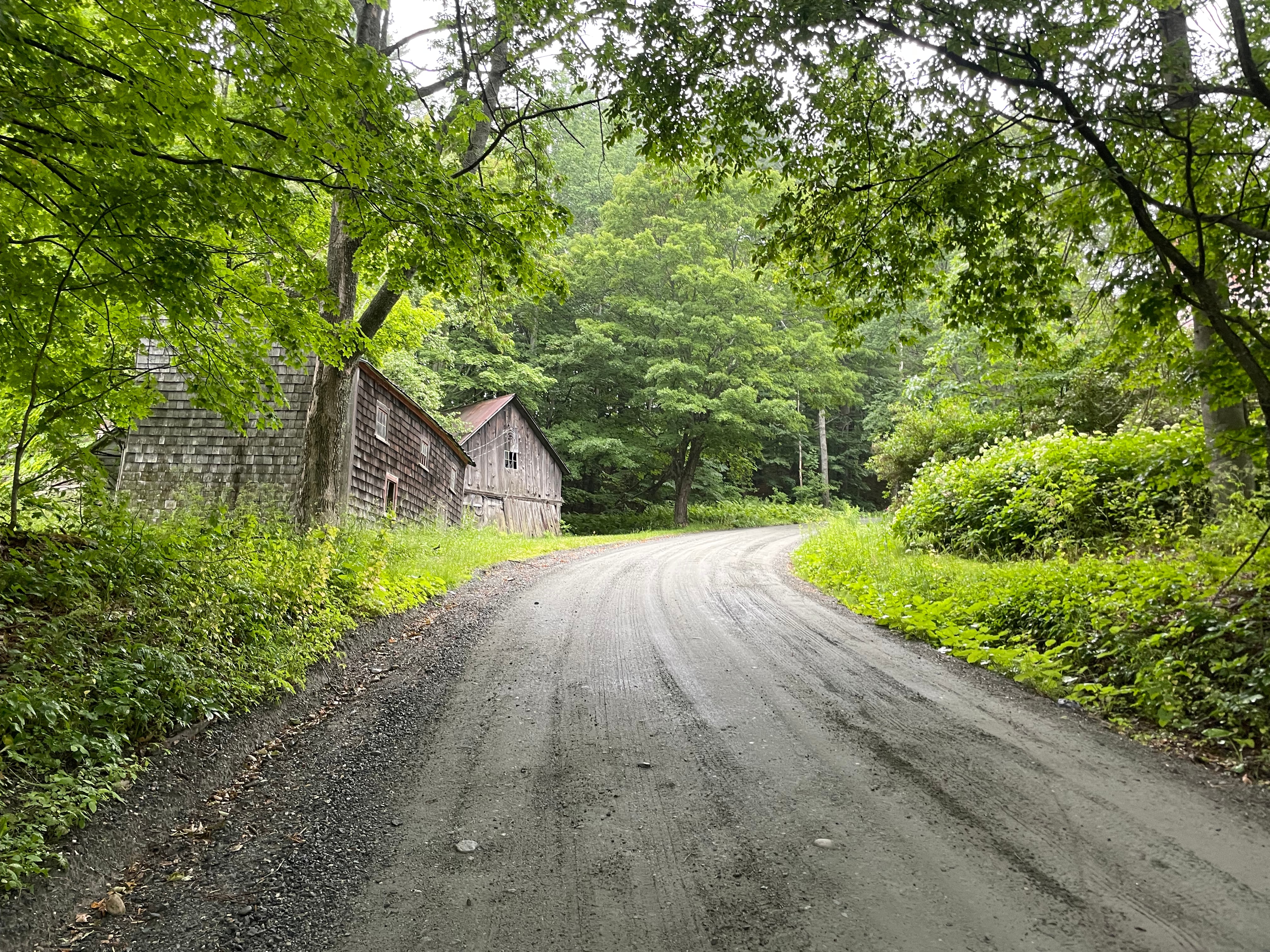
Sunday: Canaan to Burke

The VTXL wastes no time and it is not subtle; the grade hits 14% in the first half mile. After that climb is another one, and then another. We stopped for lunch in Island Pond, then pushed on toward Burke, where we had reservations at the campground run by the Burke Mountain Resort–chosen in part for its location about 60 miles into the ride, but also, importantly, because camping there would allow us hot tub privileges at the resort.
A friendly resort worker passed us on the route near our turnoff and stopped to chat. When we told her where we were camping, there was an alarming pause, and then she told what we hadn’t been able to tell from the map: that the last two miles to the campground involved an 800-foot climb. Oh, well. Wanting to be done with the day, we skipped the lively restaurants in East Burke village and crawled our way up the hill to a campground packed full of mountain bikers. (Burke is right in the middle of the famous Kingdom Trails.) After a dinner at the resort restaurant, I finally made it into the hot tub I’d been thinking about all day.
Monday: Burke to West Topsham

Morning came and we descended the mountain for an excellent breakfast at East Burke’s Cafe Lotti. Somehow we had convinced ourselves that the first day would be the hardest; this wasn’t true, as became clear today. The first day had plenty of climbing, but also long flat sections; the second day had none of these. We spent the whole day either climbing or (too-briefly) descending.
Our planned lunch stop in Danville turned out to be closed, and although I had plenty of snacks, I always have a hard time eating enough food fast enough “on the wheel”; by the last third of this ride, I was moving very slowly.
To stay on schedule to finish in five days, we hoped to reach route mile 120; but there was no campground anywhere near that point in the route. There was a country store, and we decided we would ask at the store for advice on local camping spots; at worst, we’d find a place to stealth camp off the road.
Finally we descended a steep, rough ATV trail into West Topsham and arrived at the store. Initially, it didn’t feel promising; the store was small, but right in the village, which seemed too crowded for stealth camping. We could perhaps have camped back up along the ATV trail, but the idea of climbing that hill again, in the wrong direction, was not appealing, and in any case there was no water up there. The first local we asked suggested we camp at a local ballfield, but it was almost 10 miles away, and would have put us on the wrong side of a ridge from the route for the next day.
But our fortunes soon took a turn for the better: the unprepossessing kitchen at the back of the store turned out to yield unexpectedly good pizza, and the friendly couple who live above the store offered to let us set up camp out back. Alex set up in the yard and I followed a short trail into the woods to hang my hammock near the river.
Tuesday: West Topsham to Queechee
We rose around seven. I was mindful of bonking the day before and stocked up on sugary things at the store, including a bag of Swedish Fish that would get me up the worst hills for the remainder of the VTXL.
This morning we ran into the only other VTXL rider we’d see on the route, a solo northbound rider on a hardtail. He told us there was another southbound group ten miles ahead of us, but we never managed to catch them.
There was rain in the forecast, and around noon it started to drizzle. As the afternoon went on the drizzle grew heavier and heavier, so when we arrived in Sharon for our late-lunch stop after a seven-mile descent we were both covered in mud.
On the VTXL route map there are two stores and a restaurant marked in Sharon; but Tracy’s Midway Station turned out to be out of business, and Sandy’s Takeout Restaurant was closed on Tuesdays. That left the Sharon Trading Post (now run by Maplefields). I was so filthy that I went into the bathroom to wash the mud off my face (!) before I felt presentable enough to order my coffee, sandwich, and fries.
We lingered in the store for a bit, charging batteries and watching the rain through the window. Under such circumstances, and knowing that one major climb lay between us and our campsite for the night, it was hard to find the motivation to start riding again.
Eventually, during a break in the rain, we did. At the top of Galaxy Hill Road, we saw that the road we were to descend was closed. We crossed our fingers that it would be passable by bike, and it was. At the bottom, the rain picked up; but by the time it really started storming, later that night, we had already set up camp at our lean-to site in Queechee State Park.

Wednesday: Queechee to Winhall Brook

It rained overnight but the morning was clear, and we got back on the road after a disappointing (but caloric) breakfast in Queechee. More climbing, of course. There’d be only one stop with services all day, in Cavendish/Proctorsville, around mile 40, and we weren’t sure what to expect. As usual, the restaurants on the route map were closed, but the incredible Singleton’s General Store was open. Not only do they have a live beehive built into the wall next to their front door, they also make great sandwiches with meat from whole animals butchered on the premises. I had brisket, mustard, and caramelized onions on rye bread and it was one of the best things I’ve eaten this year. Maybe it was a bit heavy considering the climbing we had ahead of us still, but it was so worth it.

Proctorsville is a mile or so off course, and as we’d ridden into town that mile felt gently downhill. So I was expecting a bit of a climb back to the route. But a funny thing happened: it felt like a descent on the way back, too! I have no explanation for this phenomenon. Maybe it was the sandwich, or maybe the city planners of Proctorsville have learned the secret of building roads that are downhill both ways. Of course, once we rejoined the route, it was back to climbing.
A couple mountains later we arrived at lovely Lake Lowell, where I stopped for a swim while Alex continued to the campground (only a few miles away at this point). Although the sun was getting low in the sky, and the day was cooling off, the water was still warm enough to relax for a while.
The last miles into camp followed the beautiful West River Trail through the woods, and as the woods were a bit dim by now I turned on my lights. But a week of Vermont dirt seemed to have done a number on the inexpert crimps in my dynamo wiring, and the connection was intermittent and the lights flickered on and off. Time to get a real crimping tool, I think.
At Winhall Brook Campground Alex had found us a lean-to site by the river, and the camp host kindly brought us a load of firewood on a golf cart.
I strung my hammock between the lean-to and a nearby tree, and was asleep pretty soon after I finished my ramen.
Thursday: Winhall Brook to Williamstown

We woke up excited, but nervous. Today, barring any major mechanicals, we would finish the ride. But the longest climb of the VTXL was still ahead, about ten miles ahead of us: the singletrack IP (International Paper) Road up Stratton Mountain.
This would be my third encounter with Stratton. In 2018, attempting to reach the Grout Pond campground via a Komoot “road” route, I climbed Stratton on pavement before the route turned into a snowmobile trail (which would have connected–though I didn’t make it that far–to the IP road). I was on 28mm tires and was not expecting a trail; by the time the pavement ended, it was dark, raining, and 40 degrees; and as far as I could tell from my headlamp, the trail seemed to be mostly under several inches of water. I bailed to a nearby hotel.
Then last year, on the Roundabout Brattleboro, we went over Stratton on the IP road in the opposite direction. I remembered the descent being steep, sandy, and loose. Today it would be a climb, and I had been dreading it for days.
But although long, the grade was not as steep as it had seemed on the descent, nor was the surface as loose. The singletrack through the woods was beautiful, with the occasional breathtaking view through a break in the trees. The climb I’d feared turned out to be my favorite part of the VTXL.

The descent (ten miles long!) was on smooth dirt, gently curving along the Roaring Branch River. At the bottom I stopped for a swimming hole while Alex went ahead to the lunch stop at the Chippenhook General Store. (The river was much colder than yesterday’s lake had been, so it was a quick dip.)
After solid sandwiches, fries, and gelato at the store, we were in the home stretch. We knocked out more big climb (Mount Anthony, near Bennington), then passed through Pownal–the last town in Vermont–then began to climb again toward the Massachusetts border. (My heart stopped when we ran into two walkers at the bottom of this last climb who exclaimed, disbelieving: “Are you going to ride all the way to the top?” But it was a short-ish climb, by VTXL standards.)
Finally, we reached the border marker (I rode past without noticing, until Alex called me back). A man living nearby offered us water, and we took a minute to rest before riding the few miles back to my car in Williamstown.

Final Thoughts
I’ve really enjoyed both of Joe Cruz’s routes so far, and I hope to ride his other northeastern routes (the Green Mountain Gravel Growler and the Delaware County dirt circuit) soon.
Despite the dire warnings of the bike shop folks, I rarely found myself wishing for a bigger tire than the 38mm knobbies. I did spend most of the ride wishing for lower gears. My lowest gear was 30-34, which is the same as the lowest gear in Shimano’s GRX group, but this is really a route for mountain-bike gearing, not gravel gearing.
Aside from one rainy afternoon and evening, we had near-perfect weather and no mechanicals (not even a flat!) Rides like this keep me coming back to Vermont every chance I get.