I Touring Lake Champlain and the Green Mountains. i

(Note: this is the first of two planned posts about this trip. In this post, I’ll describe my route and the events of each day of the tour; in a followup post, I’ll discuss some of my gear—especially gear I haven’t used before—and how it worked on the road.)
Last fall I visited Northampton, Massachussetts for work. Because I’m a train guy, I took the Amtrak Vermonter. Because I’m a bike guy, I noticed that each car on this train has a bike rack. Naturally, I started thinking about a tour.
Last Saturday morning I boarded the northbound Vermonter at Penn Station with my bike, bound for St. Albans near the Canadian border—the end of the line. I arrived late, slept at a bed-and-breakfast half a mile from the station, and set off the next morning to tour Vermont.
Sunday

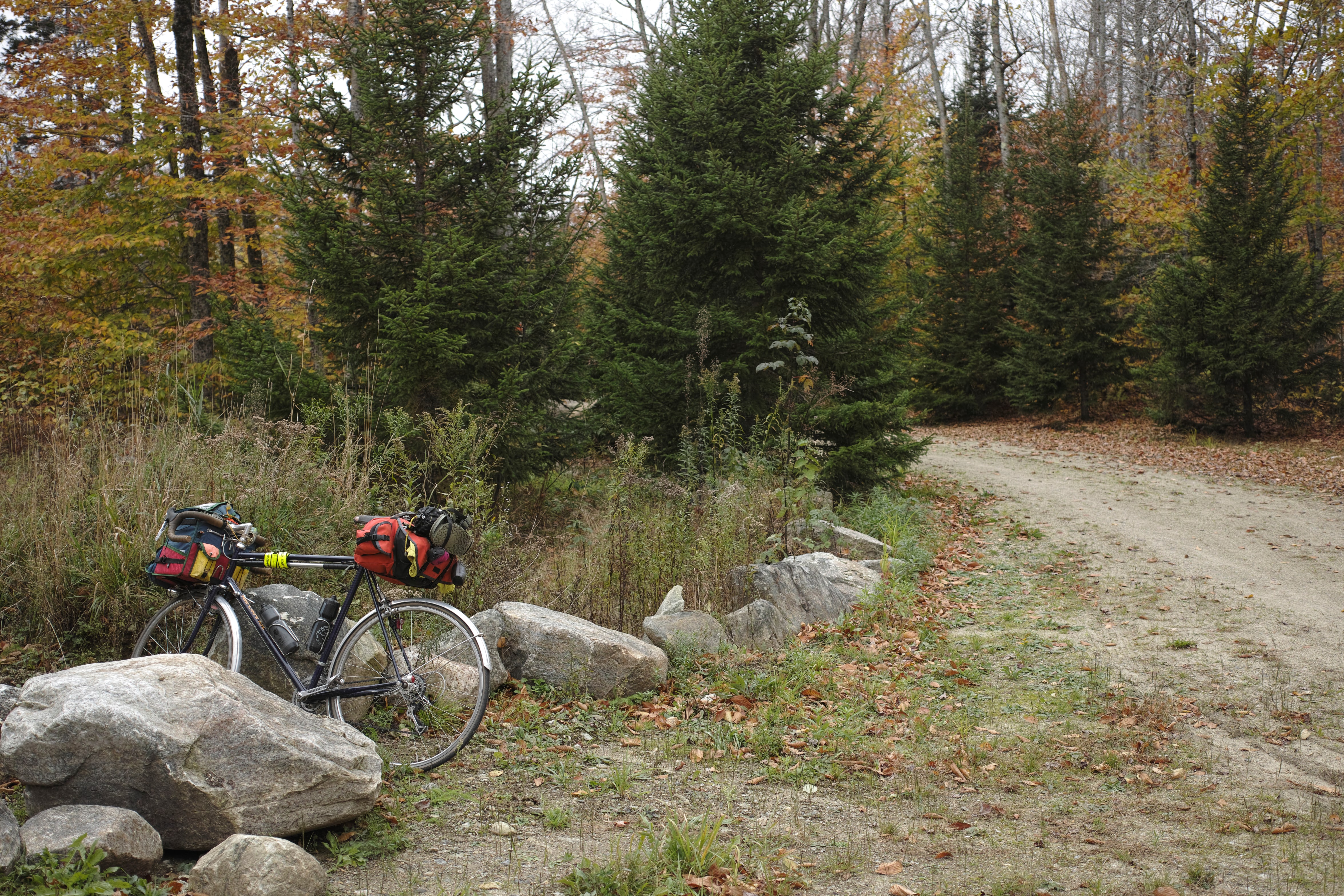
My plan was loosely this: to spend the first day riding the sections of the Champlain Bikeway on the islands of Grand Isle, North Hero, and South Hero, ending up in Burlington.
The weather was perfect, and the riding on the islands was everything I’d hoped. There is Champlain Bikeway signage all along the route, and even signage indicating rest areas, like the Snowfarm Vineyard, which had a water barrel and portable toilet for cyclists.

Much of the route follows the shoreline, and the views of Lake Champlain—and, across it, the Adirondacks—were spectacular.
Unfortunately, I didn’t get to ride the famous causeway section of the Island Line Trail from South Hero to Burlington, because the bike ferry—necessary to get across a 200-foot gap in the causeway—had closed for the season only days before. Instead, I took US Route 2 back to the mainland, then rode down to Burlington. (Sadly I did not fly across the water, as the RideWithGPS track would indicate—I forgot to turn recording back on for a bit after a crucial muffin stop.) Somewhere along here, I pulled off the road in a narrow-shoulder section to let someone pass, lost control in the adjacent very soft gravel, and broke my fall with my left foot in a way that caused what I suspect is a subungual hematoma in my left big toe; this toe would bother me for the rest of the trip.
Most of Sunday’s route was fairly flat and I was able to make good time, arriving in downtown Burlington around three. I’d left my shoe covers at home and then regretted it the whole train ride north, so I stopped at the Outdoor Gear Exchange, an incredible independent outdoor retailer, where I was able to grab new shoe covers and a pair of neoprene gloves on clearance.1

After shopping and dinner in Burlington, I took a lakefront bike trail less than two miles to the North Beach Campground, a nice in-town campground immediately adjacent to the bike path and a lovely beach. I believe this was the campground’s last night for the season; most of the developed Vermont campgrounds had closed the weekend before. For the rest of the trip, I’d planned to stay at various less-developed primitive camping areas which remained open year-round.
I noticed a nice All-City bike with full fenders at the adjacent site, and soon my neighbor came over and introduced herself: she was in town from Pennsylvania for the Old Spokes Home’s Fall Fundo ride! In general, the amount of bike traffic and infrastructure in Burlington was incredible; the waterfront trail on this blustery October evening reminded of me Chicago’s Lakefront Trail in mid-summer.

Monday
I made two unpleasant discoveries on Monday morning. The first:

The extremely aggressive squirrels at this campground had gotten into my food2 (I think it was the paprika in my freeze-dried rice and beans that was calling to them) the night before when I’d left my front bag open for a few minutes, so in the morning when I grabbed some clothing I loosely closed it for the few minutes it took me to change—but apparently loosely-closed wasn’t closed enough, because when I got back the squirrels had gotten into it again, and this time they’d managed to chew holes in the bag’s fabric itself!
This was annoying but not catastrophic, as the holes are in a section that is covered when the roll-front closure is used, and frankly this bag is not that waterproof anyway. The next discovery was a bigger problem:

This is my Velogical rim dynamo, which I’ve used for a while to power my front light, and which on this trip I also planned to use in combination with the Sinewave Revolution (a Christmas gift from M—) to charge my phone, rear lights (if necessary), etc. There is a rubber O-ring which fits around the groove at the top of the dynamo and constitutes the wear surface between the rim and the dynamo. This O-ring had been there the day before—when I’d been using the dynamo to charge my phone for much of the day—but now it was nowhere to be seen! I scoured the campsite but couldn’t find any sign of it. Another victim of Burlington’s squirrels? I have no idea.
The O-ring I’d had had come with the dynamo, and was supposedly made of some special extra-durable compound, but I hoped I could find something locally that would work, and I was right. At the Ace hardware store only about a mile away (in the wrong direction, of course), I bought a number of different sizes of O-ring from their plumbing section, and had the best results with one with an inner diameter of 1 ¼”. Whatever mysterious force had taken my original O-ring didn’t bother me again; the replacement remained undisturbed for the remainder of the trip.
On my way out of town I stopped at Handy’s Lunch for a hearty diner breakfast—during which it began to rain in earnest. It would rain on-and-off throughout the day and into the night, but most of the time it was a fairly light rain—nothing too hard to deal with.

The day’s lunch stop was the Bristol Cliffs Cafe in Bristol, where I ate a very good chicken pot pie and warmed up with tea while I looked at various maps and tried to determine the best way to the US Forest Service campground at Silver Lake, my destination for the night.

My planned route would have taken me east from Bristol, up into the mountains, and then south to the campground. But I’d been playing with the Komoot route-planning app, and it suggested an alternate route that would take me out of Bristol to the south, only turning east (and up) at the end of the ride. I decided to give the Komoot route a try, thinking that less time in the upper elevations would probably mean less climbing overall.
For a while, the route was indeed quite pleasant.


At the end of the route, though, Komoot had decided—despite my choosing the cycle-touring routing mode (the other options are road and mountain biking)—to send me up the side of the mountain on singletrack. (I would fail, at this point, to take the correct lesson from this.) I don’t mind a bit of underbiking, but the grades here were too much for me, and I ended up pushing my bike much of the way.

The campground was, as far as I could tell, deserted, so I picked the first campsite I came across, right next to the lake. A welcome break in the rain let me set up my camp in semi-dry conditions, but it would resume overnight, accompanied by vast thundering gusts of wind down the mountainside. Sometimes a gust would be a bit higher up, and I’d hear it in the treetops like a freight train; other times it would come down to the ground and rattle my tent worryingly. I hadn’t camped in these conditions before and probably made errors in tent pitch and site selection; the door to my tent flapped all night and sometimes spray came in underneath, but I managed to keep mostly dry and warm enough.

Tuesday
Tuesday dawned crisp and windy, but the rain had stopped and the sun was back. Breakfast was tea and a pastry I’d brought from Bristol the day before. I’d arrived at the campsite via singletrack from State Route 53 to the west; I planned to join Silver Lake Road, just to the east of the campground, and head south. On my map, it looked like the Leicester Hollow Trail would take me to the Goshen Trail, which went to the parking area. But when I got to the junction, bikes were prohibited on the Goshen Trail. I could (and should) have back-tracked to take a service road that bent north and then around to Silver Lake Road, but on my map I could see that the Leicester Hollow Trail eventually met up with Forest Dale Road, to the south, which was where I was trying to get to via Silver Lake Road anyway—and the trail was more direct. Up until the junction, the trail had been fairly wide, flat, and rideable—more like a fire road than singletrack. So I decided to follow it south.
This was a terrible idea. It rapidly became narrower, rockier, hillier, and mostly unrideable except for short stretches here and there. It was also significantly longer than I’d realized—almost five miles to the trailhead!

The final straw came when I emerged from the woods, with the paved road visible a couple dozen yards away—just past a bridge that was under construction. Fortunately, the bridge worker had no problem letting me roll my bike across the bridge even though they’d recently poured concrete. I was finally on pavement, but well behind schedule. It was 10:30, and this was supposed to be one of my longest days at 80 hilly miles.
Today’s lunch stop was Rutland, but conscious of the time pressure, I kept it short, then pushed on—again, using Komoot to suggest a route rather than following the route I’d designed on RideWithGPS. There was a long climb up South Mountain, then a descent into Weston, where I passed the Vermont Country Store.

Past Weston and Londonderry I began to approach the foot of Stratton Mountain just as dusk fell. Switching on my lights and donning my reflective gear, I started up the mountain on the access road for the ski resort. For me, in the dark, with 70 loaded miles in my legs, this was a brutal climb—around 1300 feet in around five and a half miles, with sections of 14% grade near the top. I took many breaks. I walked several sections. I ate the almond scone I’d been saving for the next day’s breakfast. And then around 8pm I got to the top and realized that, once again, Komoot wanted me to ride a two-mile section of so-called singletrack to my destination, Grout Pond campground.3 But this was far worse than even the steep fire road to Silver Lake the night before. This “singletrack” was deeply rutted by the tread of some kind of earthmoving equipment, and in those ruts water was running several inches deep (though it hadn’t rained all day). Komoot’s singletrack was more like a stream. Whatever wasn’t underwater was soft, deep mud which swallowed my feet completely. I made it about ten yards (pushing and carrying my bike; it was nowhere near rideable) before giving up.
I was exhausted, cold, and now wet and muddy as well. I tried on my phone to find another route to the campground. It was grim: I’d have to go back down the mountain, circle around to the other side, and climb it again. And instead of being fewer than five miles from the campground as I’d believed, if I took this other route it would be more like fifteen. Realistically, with the climbing and my exhaustion, it could be 10pm before I reached the campsite. I just couldn’t do it. I bailed to one of the many lodges on the mountain catering to skiers.

Wednesday
I woke up Wednesday discouraged to have spent the night indoors, but eager to get back on the road. After extracting as many calories as I could from the lodge’s sad off-season continental breakfast (I believe there was one other room occupied besides my own), I went back down Stratton Mountain and retraced the previous day’s route through Londonderry and Weston, where I ate lunch at the Bryant House restaurant (part of the Vermont Country Store). This time I was following my planned route to the letter—no more Komoot for me.
Today was, at least, a shorter day—around 55 miles. The big climb was (again) South Mountain, this time across its southern flank from west to east.

Right at the top, as I pulled over to layer up for the descent, it started to rain. The rain grew heavier, and by the bottom of the descent into Ludlow, it was a fairly hard rain. I stopped at a Dunkin Donuts and tried to wait it out; after a bit, it had lightened, though it would continue to rain on and off for the rest of the day.
After Ludlow I passed the Calvin Coolidge Historical Site and this cool little spring-fed fountain:

In Bridgewater I turned onto the dirt Curtis Hollow Road, then a couple miles later onto the forest road leading into Calvin Coolidge State Forest, where primitive camping is permitted year-round.

I made my camp in a clearing with a fire ring a few miles in—a mistake, since once again the wind was savage all night, and the clearing provided no shelter. The rain—which had stopped for a bit—started back up as I pitched my tent, so I cooked my ramen packets in the tent vestibule, then spent a chilly, windy night listening to the wind and watching the rain turn to freezing rain, then snow.
Thursday

Thursday morning dawned cold and wet, with a dusting of snow on the ground, a sheet of ice on my tent, and my bike shoes frozen solid. (I burned some cotton-ball-and-vaseline firestarters to thaw them out enough to get them on my feet.) As I was packing up, I discovered that I’d lost my wallet from my front handlebar bag. I believe it fell out either on the forest road to the campsite or at the campsite itself the night before as I was unpacking. I looked for it, but it was a lost cause with snow covering the whole clearing and, beneath the snow, thousands of fallen leaves almost exactly the same shade of brown as my wallet. Fortunately I carry a small card case in my jersey pocket with one debit card, so I was still able to buy food for the rest of the trip, but I’d lost my driver’s license, credit card, and the $200 I’d just taken out at the ATM at the Dunkin Donuts in Ludlow on Wednesday afternoon.
I was discouraged, but couldn’t spend much time looking as my feet—in wet socks and wet shoes, with the temperature below freezing—were growing increasingly cold and numb. I had to warm up quickly, so I made the descent back to Bridgewater, where the Bridgewater Corners Country Store was fortunately open (nothing else was) and serving coffee and (massive) cinnamon rolls.
Somewhat warmed, I set off toward Randolph, where I’d catch the southbound Vermonter home the next morning. Originally, my plan had been to proceed through Randolph to camp at Roxbury State Forest, about 15 miles further; but those 15 miles were largely uphill, and after the previous night I was less enthusiastic about backcountry camping at higher elevations, so I was hoping to find a place to camp in Randolph itself.
But I’d pass through several other towns on my way. The first was Woodstock—the Windsor County seat and visibly prosperous (a branch of the Rockefeller family kept a farm nearby, now a historic site). At the local library, which was having a book sale, I picked up (for $3) a paperback in anticipation of the long train ride home (John Lanchester’s The Debt to Pleasure, chosen in part because I’ve enjoyed his other writing, and in part because of its extremely packable size).

After Woodstock came Barnard (where I stopped at the Barnard General Store—established 1832!—for chili and a sandwich), then Bethel, then Randolph.
In Vermont (I learned) it’s common for small towns to have a “town forest.” Randolph has several, one of them behind a cemetery less than a mile from the downtown Amtrak platform, and that’s where I hoped to camp. I hung this hope on one sentence in the town’s web site blurb for the forest: “Walk the paths, take a picnic, and even sleep under the trees, all within walking distance of downtown.” I took that to mean camping was permitted, and indeed, when I arrived, the signs were clearer: you can camp for up to three days, and you can even build a fire!

The forest abuts the rail line, and Thursday evening as I sat reading by my fire, I watched the northbound Vermonter speed past. This low-lying site was nicely sheltered from the wind, and I slept soundly despite a low temperature in the twenties.
Friday
I took down my tent for the last time (dog-walkers were already out on the trail) and walked my bike out of the forest and into town, where I found a hospitable coffee shop to kill a few hours until my mid-morning train.
-
The shoe covers—from Craft—turned out to be astonishingly shoddy. The uppers began to separate from the lower section after less than a day. The velcro strap across the bottom of one shoe cover fell off day or two after that. I managed to keep them going for another day or two with duct tape, and they were better than nothing for the few days they remained usable, but if I’d paid the full price ($60!) for these I’d be apoplectic. Even at $15 they were a rip-off. Don’t buy anything from Craft. ↩
-
I planned to hang my food to keep it safe from bears in the more remote campgrounds, but hadn’t bothered at North Beach since this campground is right within the city of Burlington and was full of RVs, barbecues, etc. ↩
-
I had seen earlier when planning with Komoot that a short section of singletrack was included, but had misread the map and believed this was simply the campground access road described in the US Forest Service map of Grout Pond, which is vehicle-accessible. ↩